Lidar technology, short for Light Detection and Ranging, has revolutionized various industries with its ability to accurately measure distances and create detailed 3D maps. By using laser pulses and sensors, lidar systems provide high-resolution data for a wide range of applications, including autonomous vehicles, environmental monitoring, and urban planning. In this article, we will explore how lidar technology works, its applications, advantages, limitations, recent advances, and future trends.
How Lidar Technology Works
This technology operates by emitting laser pulses and measuring the time it takes for the light to return after hitting an object. The process involves several key components working together to capture precise data.
Components
A typical lidar system consists of the following components:
Laser Source: This generates short, intense pulses of laser light, often in the infrared spectrum, which is invisible to the human eye.
Scanner: The scanner directs the laser beam in multiple directions, covering a wide area. It can be a rotating mirror or a micro-electro-mechanical system (MEMS) scanner.
Receiver and Sensor: The receiver detects the reflected laser pulses and measures their time of flight. It is equipped with a sensor that converts the received light into an electrical signal.
Laser Emission and Scanning
In operation, the lidar system emits laser pulses that travel towards the target area. The scanner controls the direction of the laser beam, rapidly sweeping it across the scene. By measuring the precise angle and direction of the emitted pulses, the system can later determine the location and geometry of objects in the environment.
Reflection and Detection
When the laser pulse encounters an object, it reflects back to the lidar system. The receiver detects the returning pulses and measures their time of flight. By knowing the speed of light, the system can calculate the distance between the lidar sensor and the object with exceptional accuracy.
The process of emission, scanning, reflection, and detection is repeated multiple times per second, allowing systems to create a comprehensive point cloud representation of the surroundings.
Applications
Lidar technology finds applications in various fields due to its versatility and accuracy. Let me highlight some of the key areas where it is extensively used:
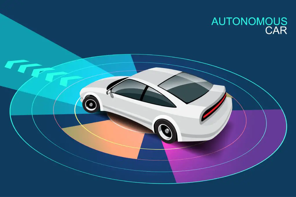
Autonomous Vehicles and Navigation
One of the most prominent applications of lidar technology is in autonomous vehicles. Lidar sensors mounted on self-driving cars and drones enable them to perceive and navigate their surroundings accurately. By generating detailed 3D maps in real-time, these systems assist in object detection, lane identification, and obstacle avoidance, ensuring safe and reliable autonomous navigation.
Environmental Monitoring and Conservation
Lidar systems play a crucial role in environmental monitoring and conservation efforts. It helps scientists and researchers study forests, wetlands, and ecosystems by providing detailed information about vegetation structure, canopy height, and biomass. Lidar data aids in assessing deforestation, habitat loss, and carbon sequestration, enabling effective conservation strategies and sustainable land management.
Archaeology and Cultural Heritage Preservation
In archaeology and cultural heritage preservation, lidar technology has proven invaluable. By capturing precise 3D measurements of landscapes, ancient structures, and artifacts, lidar enables archaeologists to map and analyze archaeological sites with great accuracy. It aids in the discovery of hidden structures, the documentation of fragile or inaccessible sites, and the preservation of cultural heritage for future generations.
Urban Planning and Infrastructure Management
Urban planners and city authorities benefit from lidar in urban planning and infrastructure management. Lidar data provides detailed information about buildings, roads, and terrain, aiding in urban mapping, land surveying, and infrastructure design. It enables precise measurements for construction projects, flood modeling, and the assessment of transportation networks, leading to more efficient and sustainable urban development.
Forestry and Agriculture
This technology has revolutionized forestry and agriculture practices. It helps foresters assess forest resources, track changes in tree height and density, and monitor the health and growth of vegetation. In agriculture, lidar data assists farmers in precision farming, optimizing irrigation, and crop management. By providing accurate measurements of terrain, canopy height, and vegetation distribution, lidar contributes to maximizing yields and minimizing environmental impact.
Advantages
This technology offers several advantages that make it a preferred choice for various applications:
High Precision and Accuracy
Lidar systems provide exceptional precision and accuracy in measuring distances and capturing detailed 3D information. With millimeter-level accuracy, lidar data enables precise mapping, object detection, and analysis, crucial for applications such as autonomous driving and environmental monitoring.
Wide Range of Detection
Lidar systems can detect objects at varying distances, ranging from a few meters to several kilometers. This wide range of detection allows for the mapping of vast areas and the identification of both nearby and distant objects, making it suitable for applications such as aerial surveys, urban planning, and long-range object detection.
Ability to Generate Detailed 3D Maps
By capturing multiple data points per second, lidar systems create highly detailed 3D maps of the environment. These maps include information about object height, shape, and spatial distribution, providing a comprehensive understanding of the surroundings. The detailed 3D maps are invaluable in applications like autonomous navigation, urban planning, and forestry management.
All-Weather and Day/Night Operation
Unlike some other sensing technologies, lidar is not affected by adverse weather conditions or lighting variations. It operates effectively in rain, fog, and darkness, making it reliable for continuous data collection in various environmental conditions. This capability is particularly important for autonomous vehicles that need to operate in any weather or lighting situation.
Limitations and Challenges of Lidar Technology
While this technology offers numerous benefits, it also has certain limitations and challenges that need to be considered:
Cost and Size Constraints
Lidar systems can be expensive, especially those with high-resolution capabilities and longer detection ranges. The cost of the equipment and the processing requirements can limit their widespread adoption in certain industries. Additionally, lidar sensors can be bulky and require significant space for installation, which may pose challenges in compact or weight-sensitive applications.
Limited Range in Certain Conditions
Although lidar systems can detect objects at considerable distances, certain atmospheric conditions, such as heavy rain, dense fog, or dust, can limit its effective range. The scattering and absorption of laser pulses by these conditions can reduce the accuracy and reliability of lidar measurements.
Sensitivity to Interference and Obstacles
Lidar systems can be sensitive to interference from external sources, such as other lidar systems or strong light sources, which can affect the accuracy of measurements. Additionally, obstacles in the environment, such as trees or buildings, can block or reflect laser pulses, leading to incomplete or distorted data.
Data Processing and Storage Requirements
Lidar systems generates vast amounts of data, especially in high-resolution applications. Processing and analyzing this data require powerful computing resources and efficient storage solutions. Managing and interpreting the large datasets can be time-consuming and may require specialized software and expertise.
Recent Advances and Future Trends in Lidar Technology
This technology continues to evolve, driven by advancements in laser technology, sensor miniaturization, and data processing algorithms. Here are some recent advances and future trends in the field:
Miniaturization and Integration
Lidar sensors are becoming smaller, lighter, and more compact, enabling their integration into a wide range of devices and platforms. Miniaturization allows for the deployment of it in smaller drones, handheld devices, and even wearable gadgets, expanding its applications in areas such as personal mapping, augmented reality, and indoor navigation.
Improved Resolution and Range
Ongoing research and development efforts aim to enhance the resolution and range capabilities of lidar systems. Higher resolution enables the capture of more detailed 3D maps, while extended range allows for long-distance object detection and mapping. These improvements will further enhance the accuracy and effectiveness of lidar technology across various industries.
Integration with Other Sensing Technologies
To overcome the limitations of lidar technology individually, integration with other sensing technologies, such as radar and cameras, is being explored. Combining different sensor modalities can provide a more comprehensive perception system, enabling better object recognition, localization, and tracking. This fusion of sensor data holds great potential for advanced autonomous systems and robotics.
Enhanced Data Processing and Analysis
Efforts are underway to develop advanced algorithms and software for lidar data processing and analysis. Machine learning and artificial intelligence techniques are being employed to automate data interpretation, object recognition, and feature extraction. These advancements will streamline the extraction of actionable insights from lidar data and facilitate real-time decision-making.
Conclusion
Lidar technology has emerged as a powerful tool for precise distance measurement, 3D mapping, and environmental sensing. Its applications span a wide range of industries, including autonomous vehicles, environmental monitoring, urban planning, archaeology, and agriculture. While it offers numerous advantages, it also faces challenges such as cost, range limitations, and data processing requirements. However, ongoing advancements in this technology, such as miniaturization, improved resolution, and integration with other sensors, continue to expand its capabilities and open up new possibilities. As the field progresses, it is poised to play an increasingly vital role in shaping the future of various industries.
Frequently Asked Questions (FAQs)
How does lidar differ from radar and sonar?
Lidar uses laser light to measure distances, while radar uses radio waves and sonar uses sound waves. It provides higher resolution and more precise measurements compared to radar and sonar.
Can lidar be used for atmospheric research?
Yes, this technology is used in atmospheric research to measure atmospheric parameters such as aerosol concentration, cloud properties, and atmospheric profiles. Lidar systems can provide valuable insights into the dynamics and composition of the Earth’s atmosphere.
What are the main challenges in deploying lidar on autonomous vehicles?
Deploying lidar on autonomous vehicles involves challenges such as cost, sensor integration, and handling complex real-time data. Ensuring the reliability, durability, and scalability of lidar systems in dynamic driving conditions is crucial for the successful implementation of autonomous vehicles.
Is lidar only applicable to terrestrial applications?
No, this technology has applications beyond terrestrial environments. It is also used in airborne and spaceborne platforms for mapping large areas, monitoring vegetation, and studying the Earth’s topography. Lidar has proven useful in planetary exploration missions as well.
How can lidar contribute to disaster management and response efforts?
This technology can aid in disaster management and response efforts by providing accurate and up-to-date information about affected areas. Lidar-derived maps can assist in assessing damage, planning rescue operations, and identifying potential hazards. The detailed 3D data can support simulations and modeling for disaster preparedness and mitigation strategies.